Varanasi Map and Geography Explained
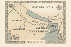
There is much more to Varanasi than just geography. The city is very old. It is actually among the oldest cities still in existence. It extends like winding roads, ghats, and a series of temples along the western bank of the Ganga River. But where exactly is it, and what makes its geography so special?
The city is located in the northern state of Uttar Pradesh, in the fertile Indo-Gangetic plain. Here, the Ganga gently curves. The river flows in its lengthy adventure from north to south, which is uncommon. This specific bend has contributed to Varanasi’s revered reputation for many centuries. This reputation has been maintained as a result of this bend.
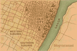
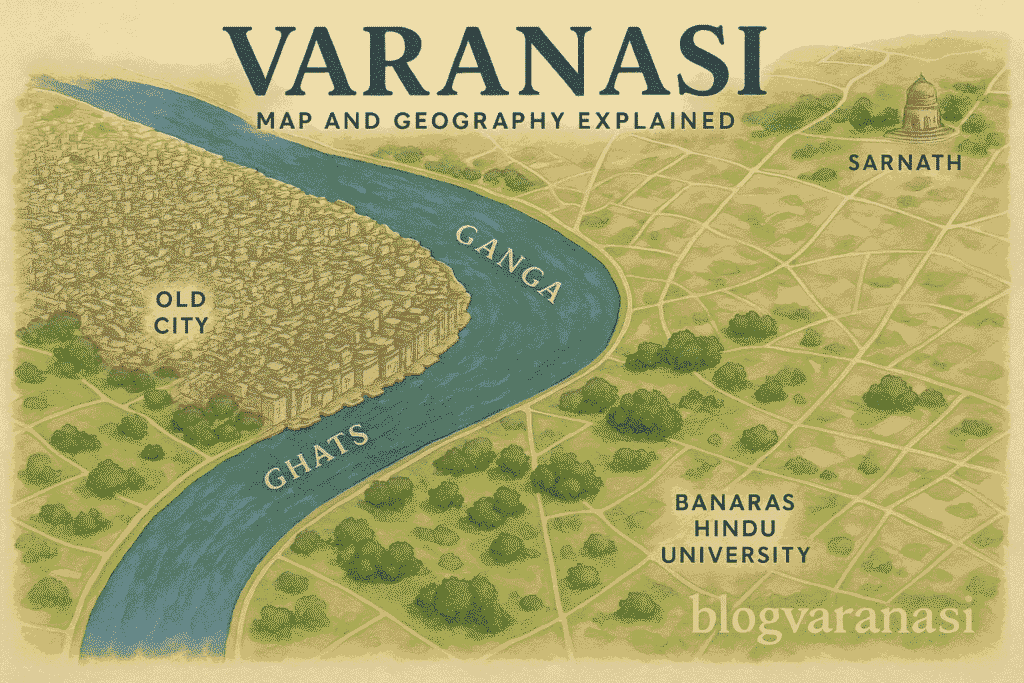
On looking at the map, you will notice:
- A natural boundary forms on the east because of the river Ganga.
- Old neighborhoods that are so close to the ghats are like a dense cluster.
- Suburbs expanding to the south and west
- Allahabad (Prayagraj) and Sarnath like nearby cities’ connections together
- Varanasi covers an area of about 112 square kilometers. However, walking in its lanes makes it feel endless. Its elevation measures about 80 meters above sea level.
Summers are hot, though they are also dry. The heat is indeed more memorable than before. Winters can be foggy. The monsoon brings rising river levels and heavy rains.
Where Is Varanasi Located on the Map?
Varanasi is located in the Uttar Pradesh state in northern India. It is located in the center of the fertile Indo-Gangetic plain, on the left bank of the Ganga River.
Its precise coordinates are approximately 82.9° East longitude and 25.3° North latitude. This indicates that it is nearly halfway between the Himalayan foothills and the equator.
On the map of India, Varanasi lies:
- Southeast of Lucknow, the state capital
- Around 800 kilometers east of Delhi
- West of Patna, the capital of Bihar
- Just 10 kilometers south of Sarnath, the place where Buddha gave his first sermon
If you open Google Maps, you will see Varanasi as a tight cluster of roads and lanes, framed by the river on one side and open fields on the other. A simple sketch-style map can show the Ganga bending gently around the city, with its ghats forming a chain along the riverbank.
So, Varanasi is not just a location. It is a point where history, geography, and faith meet.
Physical Geography of Varanasi
The Varanasi map and geography tell the story of a city that is built on one of the most fertile and historic lands in India. Varanasi lies in the center of the Indo-Gangetic Plain, a vast stretch of flat, rich terrain that has supported life for thousands of years. Its position is no accident. The city sits right on the banks of the Ganga River, where the water makes a rare and sacred northward bend before flowing east again.
This bend has shaped not just the river’s path but also the culture, trade, and spirituality of the city. The proximity to the Ganga means life here is tied to its flow, from early morning rituals to evening prayers on the ghats.
Varanasi is around 80 meters above sea level. This slight height keeps it safe from most floods while still allowing easy access to the river. The soil is alluvial-soft, nutrient-rich, and formed over centuries by the silt of the Ganga. It is perfect for farming and supports lush vegetation.
Important features of Varanasi’s physical geography:
- Location – On the Indo-Gangetic Plain in Uttar Pradesh
- River proximity – On the banks of the Ganga with a rare northward bend
- Elevation – Around 80 metres above sea level
- Soil – Alluvial and fertile
- Terrain – Naturally flood-resistant high ground
When you look at the Varanasi map and geography, you will see why people have lived here for millennia. The land, the river, and the elevation together create a perfect setting for a thriving settlement. Could this be why Varanasi has remained a living city since ancient times?
Climate and Seasons in Varanasi
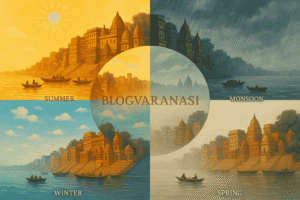
Because of its location on the Indo-Gangetic Plain and the Ganga’s flow, Varanasi enjoys a subtropical climate. Understanding the weather is important if you want to plan your trip using the Varanasi map and geography as your guide. How do the seasons change here, and what can you expect?
Summer (March–June)
Summer in V
aranasi is long and hot. Daytime temperatures can easily touch 40°C or more in May and June. The air is dry, and heatwaves are common. Walking through the ghats during midday can be exhausting, so early mornings or evenings are better for exploring.
Monsoon (July–September)
The monsoon arrives with heavy rains and high humidity. Average rainfall ranges from 900 to 1,100 mm in this period. The Ganga swells, and certain parts of the riverbank may flood. The city feels refreshed, with greener surroundings, but the humidity can be intense.
Winter (November–February)
Winter is the most pleasant season in Varanasi. Temperatures range from 5°C in the coldest mornings to about 20°C in the afternoons. Foggy mornings are common in December and January, giving the ghats a mystical look. You can enjoy while boating in the morning.
When you look at a Varanasi map and geography layout, you’ll see how the city’s climate patterns are influenced by its riverfront location and flat plains. Whether you come in the winter, hot summer, or monsoon, each season brings its own charm to the spiritual capital.
Rivers and Water Bodies Around Varanasi
The lifeline of Varanasi is the River Ganga. It flows gently but powerfully, carrying centuries of history, faith, and culture. Along its banks, life moves in rhythms shaped by prayer, trade, and tradition. Without the Ganga, could Varanasi be the same city it is today?
The Varanasi map and geography reveal more than just streets and temples. They also show the meeting of waters that gives the city its soul. Two smaller streams, the Varuna and the Assi, flow into the Ganga here. Their confluence is so symbolic that the name Varanasi itself comes from these rivers.
This meeting of waters is not only seen as a geographical fact but also a spiritual one. Hindus believe that bathing at the confluence washes away sins. Pilgrims travel from far corners of India just to stand where the rivers meet.
Key water bodies connected to Varanasi include
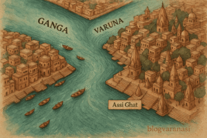
- Ganga River – sacred and central to daily life
- Varuna River – marking the city’s northern boundary
- Assi Stream – flowing into the Ganga near Assi Ghat
When you look at the Varanasi map and geography, you see that water is more than a natural resource here. It is a living presence. It shapes the land, guides rituals, and connects the people to their past. Would you not agree that a city built on such waters is unlike any other?
Geographical Influence on Culture & Faith
Why has geography shaped Varanasi’s sacred status for thousands of years? The answer begins with the Ganga River and the way the city is built along its banks.
The Ganga is not just a waterway in Varanasi. It is the heart of the city’s spiritual life. For Hindus, this river is considered divine, a living goddess who purifies the soul. People travel from across India and the world to bathe in the Ganga River, believing it washes away sins. Many also come for their final journey, hoping for cremation on its ghats so their ashes can merge with the holy flow.
The river’s role can be seen in daily life:
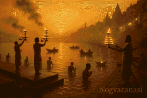
- Morning prayers and yoga sessions take place on the steps of the ghats
- Pilgrims collect Ganga water for rituals at home
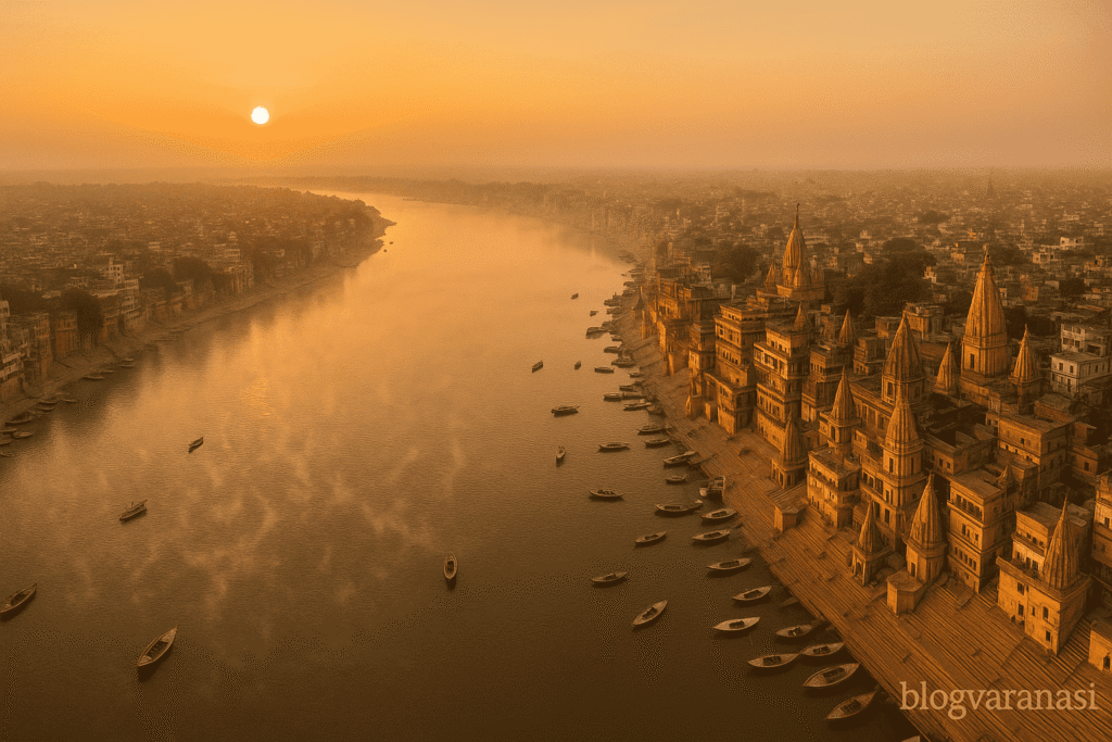
- Boat rides at sunrise give a view of chanting priests and temple bells ringing together
- Cremation ceremonies at Manikarnika and Harishchandra Ghats run day and night
In most places, the Ganges flows from north to south or west to east. But at Varanasi, the river takes a unique turn and flows northward for a short stretch. This rare bend is called Uttarvahini Ganga.
Hindus believe a north-flowing river carries blessings toward the Himalayas, the source of sacred energy. Bathing or performing rituals on such a riverbank is thought to wash away sins and help the soul move closer to liberation (moksha).
Because of this, the bend of the Ganga in Varanasi is seen as highly auspicious, making the city a powerful spiritual destination for pilgrims.
The temples are not scattered randomly. Their layout follows an ancient plan, with the Ganga as the central axis. Small shrines dot the lanes leading down to the river, while major temples rise along the higher banks, safe from floods yet close enough for devotees to reach easily.
Life in Varanasi still flows with the river’s rhythm. The Varanasi Map and Geography reveal how markets, ashrams, and homes cluster near ghats. Festivals like Dev Deepawali turn the entire riverfront into a glowing carpet of lamps. Without this geography, would Varanasi have become the spiritual capital it is today?
Map Guide: How to Read and Navigate Varanasi
Understanding the Varanasi map and geography can turn a confusing maze of lanes and ghats into an easy and memorable journey. The city is divided into key zones, each with its own charm and importance. If you know where you are and where you want to go, the experience becomes smoother and more enjoyable.
Here are the main zones you should know:
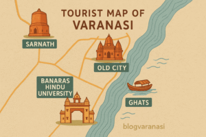
- Old City – The heart of Varanasi, full of narrow lanes, temples, and bustling bazaars.
- Ghats – The steps leading to the Ganga River, each with its own history and purpose.
- BHU Area – Banaras Hindu University, a green and spacious zone, perfect for a peaceful stroll.
- Sarnath – A historic site just outside the main city where Buddha gave his first sermon.
When reading the Varanasi Map and Geography, try using landmarks instead of street names. Many locals will guide you based on well-known spots rather than official addresses. For example, instead of asking for “Dashashwamedh Road,” say “near Dashashwamedh Ghat.”
You can explore the city in two main ways:
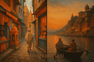
- Walking Routes – Best for the Old City and ghats, where vehicles cannot enter.
- Boating Routes – A unique way to see the ghats from the river, especially at sunrise or sunset.
Wouldn’t it be easier if you had a simple visual guide? Embedding a basic vector map or linking directly to Google Maps can save time and confusion, especially for first-time visitors.
In the end, knowing the Varanasi map and geography means you are not just a visitor; you are an explorer ready to connect with the soul of the city.
Map Guide: How to Read and Navigate Varanasi
Varanasi is not just a city. It is a maze of narrow lanes, riverside ghats, and ancient landmarks. To move around with ease, you need to understand the Varanasi map and geography. Knowing the city’s layout can save time and help you see more. But where do you start?
The city can be divided into four main zones:
- Old City – Dense lanes near Kashi Vishwanath Temple, full of shops, shrines, and street food
- Ghats – Steps leading to the Ganga River, each with a unique story
- BHU (Banaras Hindu University) – A spacious, green area with museums and temples
- Sarnath – A calm site where Buddha gave his first sermon
Landmark-Based Orientation
If you are lost, look for a landmark. The Ganga River is your best guide—it runs from north to south along the city. Famous spots like Dashashwamedh Ghat, Assi Ghat, and the Malviya Bridge can anchor your position on the map.
Walking vs Boating Routes
On foot, you can explore the Old City’s spiritual core. But remember, lanes can be confusing. By boat, you can view the ghats in a single stretch and even reach hidden areas that walking cannot cover.
Using a Map Effectively
When reading the Varanasi Map and Geography,
- Ghats are lined in a sequence from north to south
- Main roads loop around the congested Old City
- Landmarks like temples, chowks, and bridges help you navigate
You can embed a simple vector map in your travel plan or keep a Google Maps link ready on your phone. A digital map can help, but in Varanasi, asking a local often works faster.
Do you plan to walk the lanes or sail on the Ganga? That choice will shape your journey.
Summary: Why Varanasi’s Geography Matters
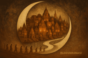
The Varanasi map and geography are not just about roads and rivers. It is about a deep connection between land, water, and faith. The city sits on the western bank of the Ganga River. This position is not random. In Hindu belief, this curve of the river creates a sacred space. It is said to be shaped like a crescent moon, a symbol of divine energy.
The geography here blends nature and spirituality. The Ganga brings life to the soil, supports rituals, and inspires countless pilgrims. Hills and plains meet in a gentle slope towards the ghats. Ancient temples stand close to the water, showing how urban life grew around faith. Can a city be both a living museum and a busy modern hub? Varanasi proves it can.
The Varanasi map and geography also influence how the city develops today. Narrow lanes and stepped riverbanks limit large-scale construction. Yet, this same terrain protects its charm. The old city remains walkable. The ghats continue to host festivals, cremations, and daily prayers.
Here are three key aspects of this unique geography:
- Natural harmony – River flow, fertile banks, and seasonal changes shape life here
- Spiritual design – The city’s placement mirrors sacred concepts in Hindu cosmology
- Urban challenge – Growth must adapt to ancient layouts, not replace them
In the end, the Varanasi map and geography are more than points on paper. They are the reason the city still feels timeless, even as it changes.
Varanasi Map and Geography – FAQ
Where is Varanasi located in India?
Varanasi, also known as Banaras or Kashi, is in the northern state of Uttar Pradesh. It lies on the left bank of the sacred Ganges River, about 320 kilometers southeast of Lucknow. If you check a Varanasi map and geography chart, you will see the city positioned between the Varuna and Assi rivers, which also inspired its name. Explore our full Varanasi travel guide for more details.
What makes the geography of Varanasi unique?
Varanasi is built along a crescent-shaped curve of the Ganges. This rare formation allows the sunrise to directly bathe the river’s ghats in golden light. The slightly elevated terrain protects the city from most seasonal floods. It’s not often that you find a place where natural safety, spiritual symbolism, and urban life blend so perfectly.
How does the Ganges River influence Varanasi?
The Ganges is Varanasi’s lifeline – a source of water, trade, culture, and faith. Daily rituals, from morning aartis to cremation ceremonies, take place along its banks. In the context of Varanasi Map and Geography, the river has shaped the city’s street layout, economy, and spiritual rhythm for over 3,000 years.
What kind of soil is found in Varanasi?
Varanasi’s soil is mostly alluvial, rich in minerals from centuries of river deposits. This makes it perfect for crops like wheat, rice, and sugarcane. Farmers here have relied on this fertile land for generations, making agriculture a quiet but essential part of the city’s identity.
Why is Varanasi’s location sacred?
Hindu scriptures say that Lord Shiva himself established Varanasi, making it an eternal city. Its position on the banks of the Ganges is believed to offer moksha – liberation from the cycle of rebirth – to those who die here. For pilgrims, the geography is not just about rivers and land; it’s about a divine connection between heaven and earth.
Author: Sumit Singh is an SEO professional and a proud son of Varanasi. Born and raised in the spiritual heart of India, he brings local insight, cultural depth, and lived experience to every word he writes.


Well explained 💫